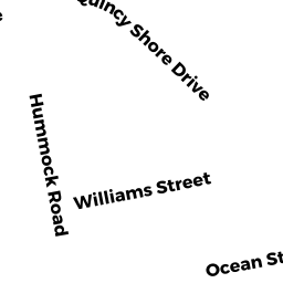
19 DITMAR ST
Owner Information
TRABUCCO GINA M
19 DITMAR ST
QUINCY, MA 02171


Property Details
19 DITMAR ST is classified as a Single Family Residential (Cape cod).
The primary structure on this property was built in 1929. There are 2,760ft2 of built area within this property. There is 1,164ft2 of residential/living space within this property. This property is listed as having 6 rooms.
19 DITMAR ST is valued at $450,100. The land is valued at $280,400 and the structures are valued at $157,300. There is an additional valuation of $12,400 on this property.
This property is in Zone RES A. Confirm with local Zoning Board authorities to ensure there are no overlays or other easements on this property.
The most recent deed for 19 DITMAR ST is recorded at the local registrar in Book 36464, Page 436. 19 DITMAR ST was last sold on Thursday, November 29, 2018 for $511,000.
Assessment data from fiscal year 2020.
Flood Data
This property is partially within the AE Zone (within floodplain). Approximately 0.08 acres (47.95%) of the property is within this zone.
The base flood elevation for this flood zone is 10 feet.
This information is sourced from the FEMA National Flood Hazard Layer. See our full disclamer.
Broadband Internet Providers
| Provider | Type | Bandwidth (mbps) | |
|---|---|---|---|
| VSAT Systems, LLC. | Satellite | 2 | 1 |
| GCI Communication Corp. | Satellite | 0 | 0 |
| Starry, Inc. | Fixed Wireless | 200 | 200 |
| Comcast | Cable | 1000 | 35 |
| Verizon New England Inc. | DSL | 10 | 1 |
| Viasat Inc | Satellite | 100 | 3 |
| HughesNet | Satellite | 25 | 3 |
Broadband service provider data from December 2020.
Adjacent Properties
- 24-26 EDGEWORTH RD
Two-Family Residential owned by MATTHEWS JOAN F ETAL TREES - 326 E SQUANTUM ST
Single Family Residential owned by STANTON ROBERT J - 34 EDGEWORTH RD
Two-Family Residential owned by ANDRADE PAUL A - 30 EDGEWORTH RD
Single Family Residential owned by GREEN ANTHONY - 17 DITMAR ST
Single Family Residential owned by TRABUCCO MICHAEL